Saturday, November 2, 2013

Studio City: Fryman Canyon, aka. Wilacre Park, aka. Betty B. Dearing Trail.


Wilacre Park.  Also know by locals as just "Fryman"
 Distance:  3 mile loop or 4 mile out and back.

Difficulty:  Easy to moderate.

Time: 45 minutes to an hour.

Views: Studio City, Sherman Oaks, Universal City, Verdugo Mountains.

Parking:  There's a large parking lot off of Fryman Road.  Parking is $3, and you'll need exact change.  Use the "iron ranger" and pay with singles or use the automated parking machine which accepts quarters.  Both are located in the parking lot.  Also, you can park on Laurel Canyon for free, if you're lucky enough to find a spot.   The residential area, known as Fryman Estates, is a strict no parking zone.  I've seen people ticketed and towed.  Just read the signs, and you'll be fine!

Parking fees and rules.
Two Iron Rangers and the Parking Machine.


Park on Laurel Canyon Blvd.  Spots Fill Quickly, Especially on the Weekend.

Directions:  From the 101 freeway exit Laurel Canyon Blvd.  Head South.  Turn right onto Fryman Road.  You'll see the parking lot immediately to your right.  From West Hollywood, take Laurel Canyon towards Studio City.  Turn left onto Laurel Canyon Road, the parking lot is immediately to your right.

Cell Reception: Spotty

Trail Condition:  Well maintained fire road.  Very populated, especially on the weekend. 

Fresh Water: There's a drinking fountain at the trailhead and one just past the summit at Tree People.  Also, there's a beautiful doggie fountain at the top.
Drinking fountain at Tree People
Doggie Drinking Fountain at Tree People


Public Restrooms:  There's a port-a-potty in the parking lot at the trailhead.  Use with caution.  It's usually full because of the popularity of this hike.

Description: I've done this trail hundreds of times, and I think it must be the most popular hiking trail in the San Fernando Valley.  It's a great place to people watch and star gaze Los Angeles style (more than likely, you'll see a celeb or two on your hike).  On the plus side, it's easy to get to, easy to park, and provides a great 45 minute workout outdoors.  On a clear day, the views are beautiful.  There are plenty of negatives, though.  This trail is always busy!  During the week, it's bustling with valley moms and both struggling and working actors.  If you want to "get away" from the hustle of city life, this is not the hike for you.  On the weekend, it's positively bustling.  

Technically, this is the Betty B.  Dearing Trail.  The Locals all Call it "Fryman".
The trail head is located right off the parking lot.  It's very easy to find.  Just follow the people.


You'll start the hike with a rigorous uphill climb on a paved 1/2 mile fire road.  This is the toughest leg of the hike.


The dirt fire road continues for most of the rest of the hike. Continue another mile to the summit and saddle. 


During the uphill climb, catch the beautiful views of Studio City and North Hollywood. 


Just after the summit, you'll come to a plateau.  The entrance to tree people is to the right.  If you have time, take a quick detour up to tree people.

Tree People's Outdoor Classroom.  Learn About Water Conservation.

Picnic Area at Tree People


My favorite spot on the hike...take a rest and take in the view of the Santa Monica Mountains and the hilly neighborhood of Studio City.

View from the bench.
Continue your hike down the fire road.  You'll come to a gate that leads to the residential portion of your hike.  

Here, you can turn back and make the hike a four mile out-and-back or continue on for a three mile loop.

The Last Leg of the Hike Through Fryman Estates

Friday, October 25, 2013

Griffith Park: Mineral Wells Picnic Area to Amir's Garden


Distance:  1 mile roundtrip

Difficulty:  easy, great for children

Time:  30-45 minutes plus time to poke around.

Views:  Glendale, the 134 freeway, Harding Municipal Golf Course.

Directions

From the 5:  
Take the Western Ave Exit. 
Go straight through the  light at Lake Street to the light at Victory Blvd.
Turn Left on Victory.
Go straight through the light at Riverside Drive, continue across the LA River Bridge until the Road dead-ends at Zoo Drive in Griffith Park.  
Turn RIGHT on Zoo Drive. 
Go straight at the stop sign at Zoo Drive and Griffith Park Drive and follow the road for about a mile to the Mineral Wells Picnic area.  
You'll pass the composting facility.  If you pass the golf course, turn around.  You've gone too far.

From the 134:  
Take the Forest Lawn Exit.
Turn left onto Zoo Drive, then your first right onto Griffith Park Drive.
Go straight at the stop sign at Zoo Drive and Griffith Park Drive and follow the road for about a mile to the Mineral Wells Picnic area.  
You'll pass the composting facility.  If you pass the golf course, turn around.  You've gone too far.

Parking:  You can park at the south end of the Mineral Wells Parking Lot (Mineral Wells Drive) if it's open.  You can also park on Griffith Park Drive or further south in the lot adjacent to the driving range.
Mineral Well Picnic Area


Cell reception?  Yes, entire hike.

Trail condition:  Well maintained fire road.  The trail is shared with horses, so watch out for those "horse apples"!

Fresh water:  in the picnic area.

Public bathrooms:  in the picnic area.

Description:

Amir's Garden Trailhead
The trailhead is south of the Mineral Wells Picnic Area right off of Griffith Park Drive.  There's no sign that says, "This way to Amir's Garden,"  but look up.  If you see a green water tank, you're in the right place.

Hike uphill.  You'll pass under that first water tower you saw at the trailhead.  About a third of a mile in, you'll have to walk around the second water tower.
The trail leads around this water tower.


Entrance to Amir's Garden


Picnic/Rest Area

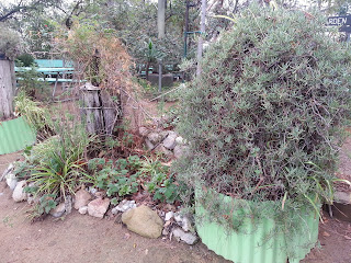
Succulents Abound

Take one of the wandering paths on the side of the hill.


Views from one of the paths at Amir's Garden.
Make sure you visit amirsgarden.org to learn more about the history and upkeep of this special place.

Tuesday, October 22, 2013

Burbank: Stough Canyon Nature Center to "The View"


Basic Info

Distance: Just under 4 miles

Difficulty: Moderate

Time:  2 hours

Views:  Beautiful views of most of the Valley.  To the south, you'll see Downtown, Griffith Park, and the Santa Monica Mountains.  To the north, you'll see the 210 freeway and the Angeles National Forest.  

Directions to trailhead:  
From the 5, take the Burbank Blvd Exit
Right onto East Burbank Blvd
Left onto North 3rd Street
Right onto Delaware Road
Right onto North Glenoaks Blvd
Left onto East Walnut Ave
Continue onto Stough Canyon Ave.  The nature center is at the end of Stough Canyon Ave.


Cell reception? Entire Hike

Trail Condition:  Well maintained fire road

Fresh Water:  Fill up at the Stough Canyon Nature Center at the trailhead.

Public bathrooms:  Clean flush toilets at the nature center.

Parking:  The parking lot at the nature center is small.  Additional parking is available on the road

Map of the Verdugo Mountains Hiking Trails


Description:
Located in the Verdugo Mountains in Burbank, the trail starts at the Stough Canyon Nature Center.  Inside the center, there are trail maps, description of the wildlife, a history of the area, clean flush toilets, and a drinking fountain.  It's worth it to pop in for a few minutes before or after your hike.
Footbridge to the nature center

Flush toilets and drinking fountain.

The trailhead


As you head up the trail, you'll pass 3 benches. This trail is an out and back, so you'll be heading up the mountain the entire way out. Be sure to turn around and catch the beautiful views of the DeBell Golf course and Burbank.  The 4th bench is about 1 mile up the trail.  This is called "The Saddle" or "4th Bench" by locals.  It's a beautiful spot to take a rest and a drink, and the view of the valley from here is amazing.
The 4th Bench or "The Saddle"

View from the 4th Bench


 At this point the trail splits. You can head left towards the Old Youth Campground or go right towards the radio towers.  For this hike, head right towards the radio towers.


Just past the split.  To the north, the 210 freeway in the distance.  Beyond that, the National Crest Forest.


Keep going up. Right around mile 2, you'll come around a hill and find one of the most amazing views of the valley.
This spot on the trail is called "The View"

Have a rest, and take in the views.  That's downtown in the distance, and Griffith park off to the left.
More views of Griffith Park and Burbank.  That patch of green is Forest Lawn.

If you want to extend your hike, you can keep going another half mile up to the radio towers.